Capture more. See more. Decide faster.
High-density aerial data collection for accurate terrain models, corridor mapping, volumetrics and confident engineering decisions.
Capture more. See more. Decide faster.
High-density aerial data collection for accurate terrain models, corridor mapping, volumetrics and confident engineering decisions.
Our professional-grade aerial LiDAR platform captures terrain, structures and vegetation efficiently — giving project teams a clearer understanding of existing conditions while reducing time spent in difficult or hazardous areas.
Colorized and classified LAS point clouds prepared for analysis, design and documentation.
Bare-earth terrain and surface models for grading, drainage and site evaluation.
CAD-ready contours, planimetric mapping and orthomosaic imagery in your project coordinate system.
Stockpile quantities, excavation progress and repeat-flight comparisons for informed decisions.
Where LiDAR works
Aerial LiDAR can capture large, complex or hard-to-access sites while maintaining a consistent, repeatable dataset across the project.
We define coverage, accuracy needs, control and the final data format.
Our field team flies the site using our aerial LiDAR platform.
The dataset is georeferenced, optimized, classified and quality checked.
You receive practical files organized for engineering and project use.


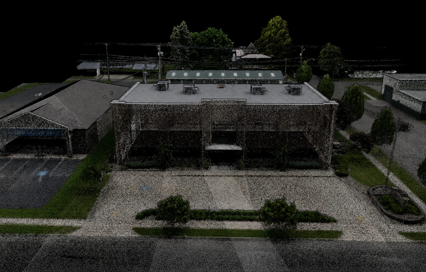
RGB Point Cloud
Full-color 3D point cloud of our New Philadelphia head office.
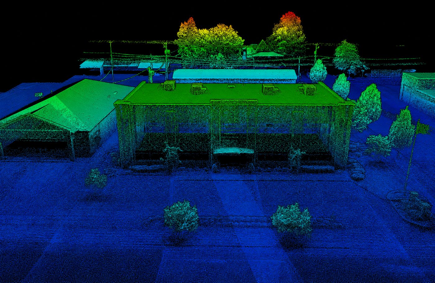
Elevation Point Cloud
Color-graded elevation model of our head office building.
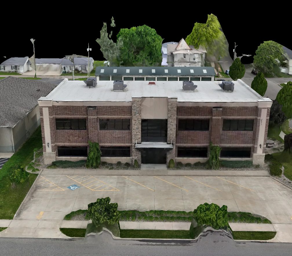
Textured 3D Mesh
Photorealistic textured 3D mesh of our New Philadelphia head office.